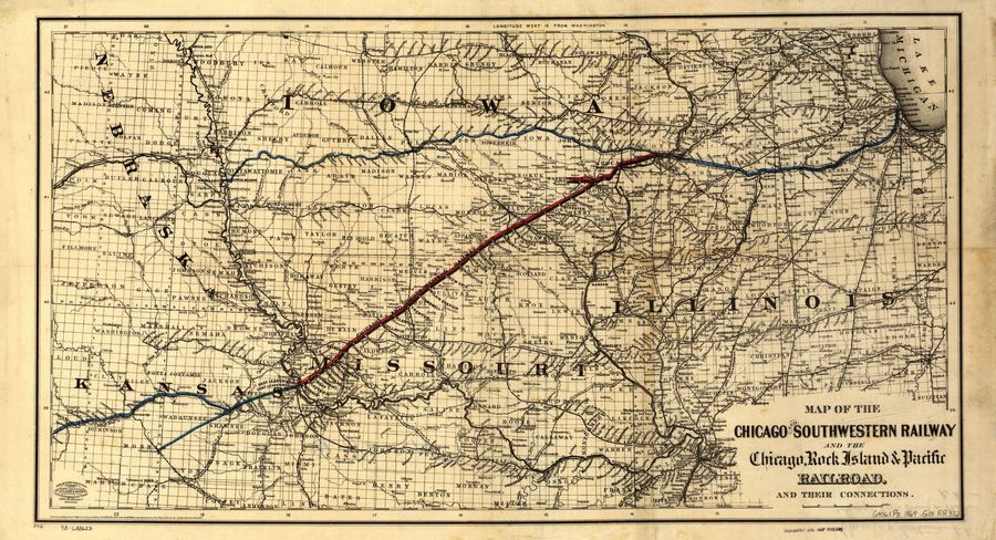
1869 Map of The Chicago, Rock Island & Pacific Railroad - Nebraska, Iowa & Illinois
By Jack Kesling; posted December 4, 2020
View Original: Click to zoom, then click to magnify (2335 x 1267) 1026KB

|
This is a Library of Congress 1869 map which traces the Chicgo, Rock Island & Pacific Railroad routes through Nebraska, Iowa, and Illinois. From Des Moines the railroad runs East and West through Iowa. West of Des Moines the railroad runs to Council Bluffs, Iowa and cross into Nebraska a little South of Omaha and than connects up with the Union Pacific / Pacific Railroad. East out of Des Moines the route goes through Iowa City, Iowa (original /early Capital of Iowa) and exits Iowa at Davenport, Iowa and goes through Illinois. By way of orientation, you will note that the Chicago Northwestern /Pacific Railroad (see the black line about the blue line) also runs East and West through Iowa (and Boone Co. IA), but is located about 40 to 50 miles North of the Chicago, Rock Island & Pacific Railroad which runs East and West through Des Moines (see the blue line). Both of these railroad connect with the Union Pacific near Omaha, Nebraska. Although both of these railroads are very old, I have not heard of any threadless insulator being found on the two routes through Iowa. Again, the best way to use this map is to download to your hard drive and expand it on your desktop. |